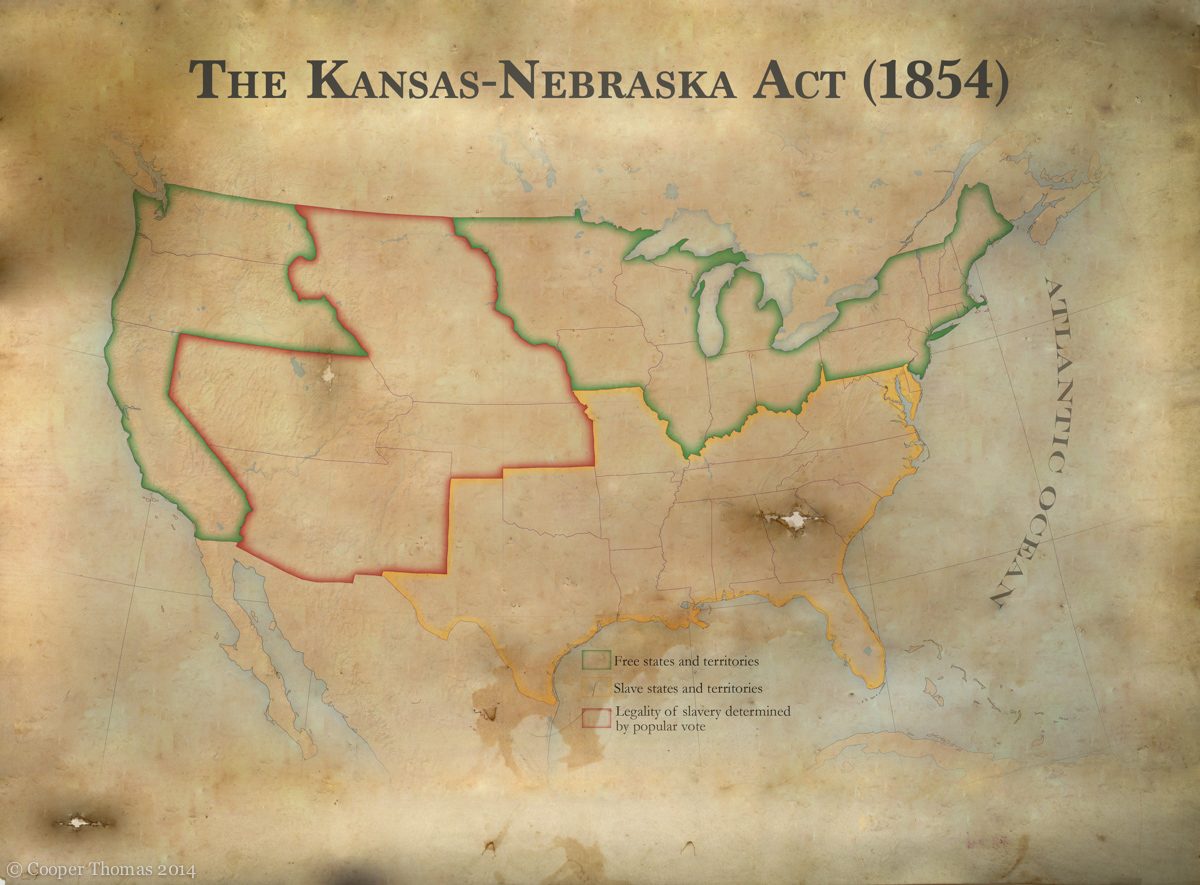
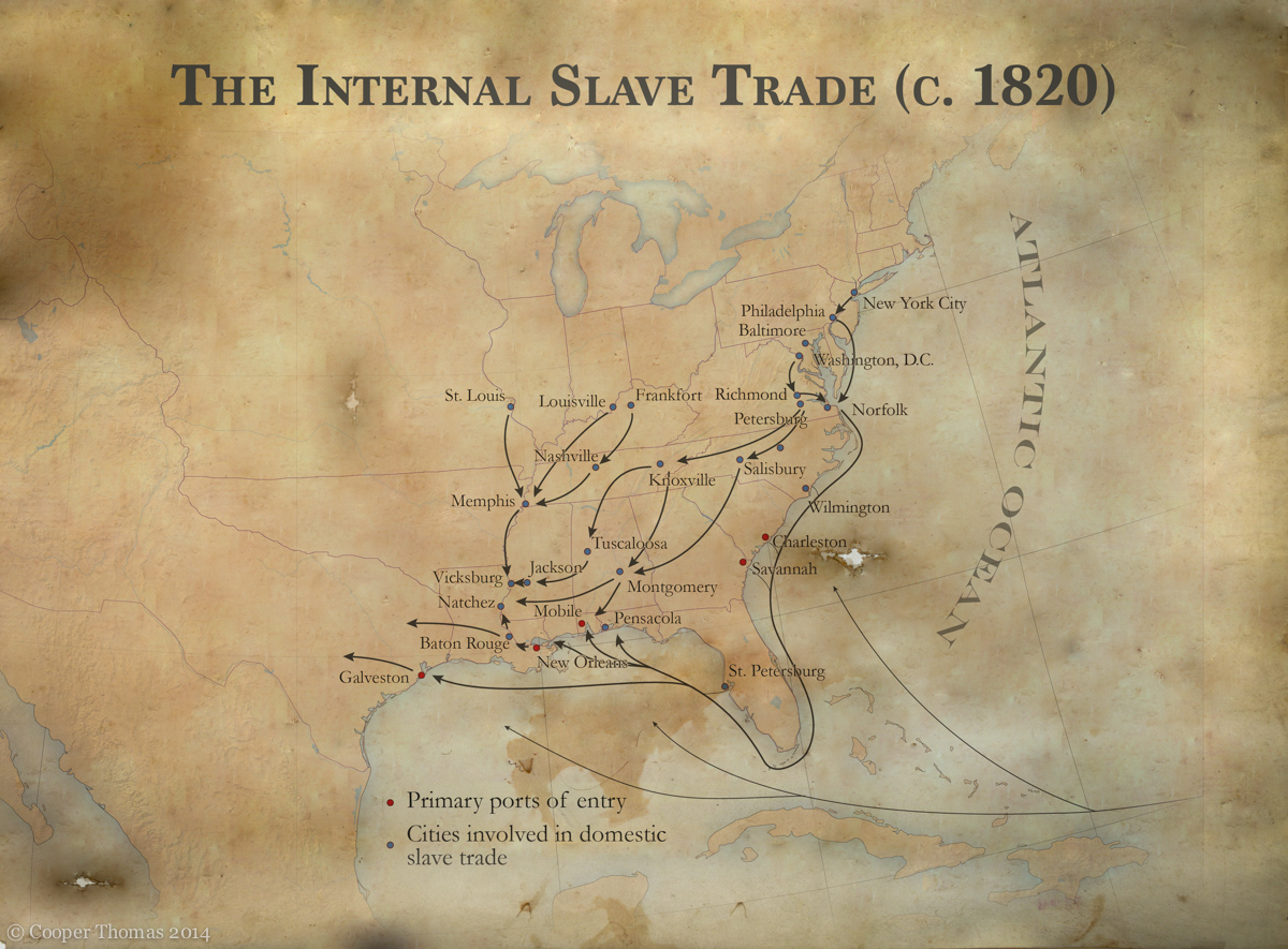
One of my first assignments as a content production intern at Second Story Interactive Studios was to research and design a series of static maps tracing the history of slavery in the United States. Here are a few of these maps, gratuitously stylized in old-timey fashion. (I had to submit the maps with number of different aesthetic treatments; this was one of them.) I recently handed my frames over to an animator, who will blend them into a seamless cinematic narrative. I am delighted to have had the opportunity to work on such an interesting project, and I wait with eager anticipation for these maps to spring to life.
Edit: these maps have been incorporated into a permanent exhibit at the National Civil Rights Museum in Memphis. Cool!


