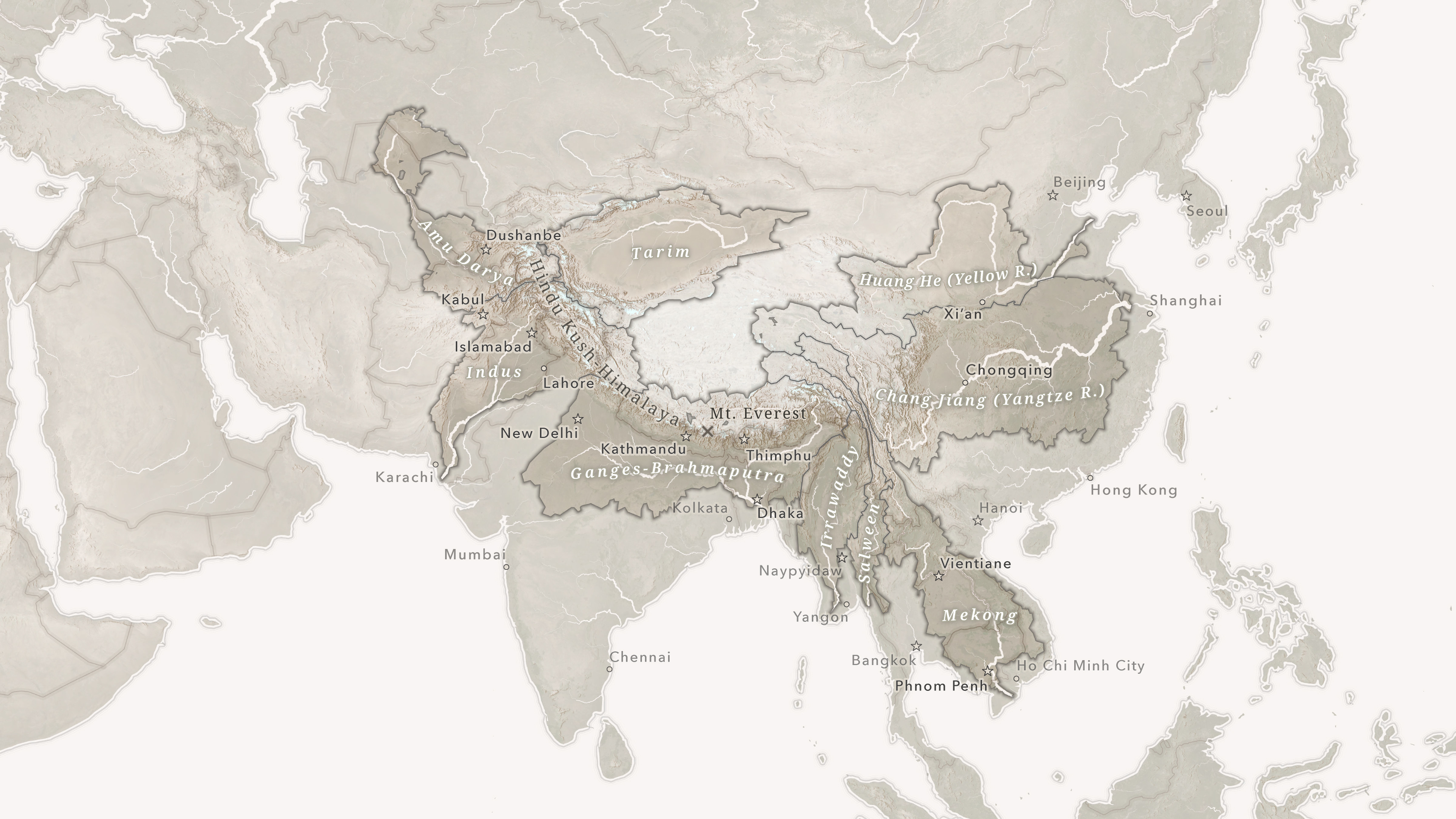
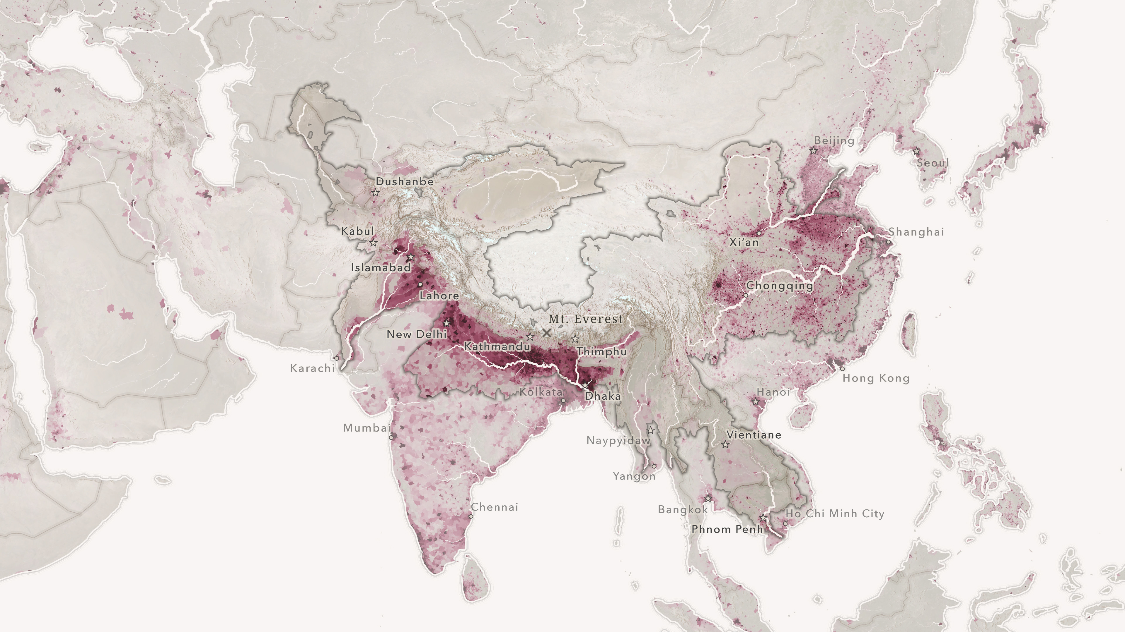
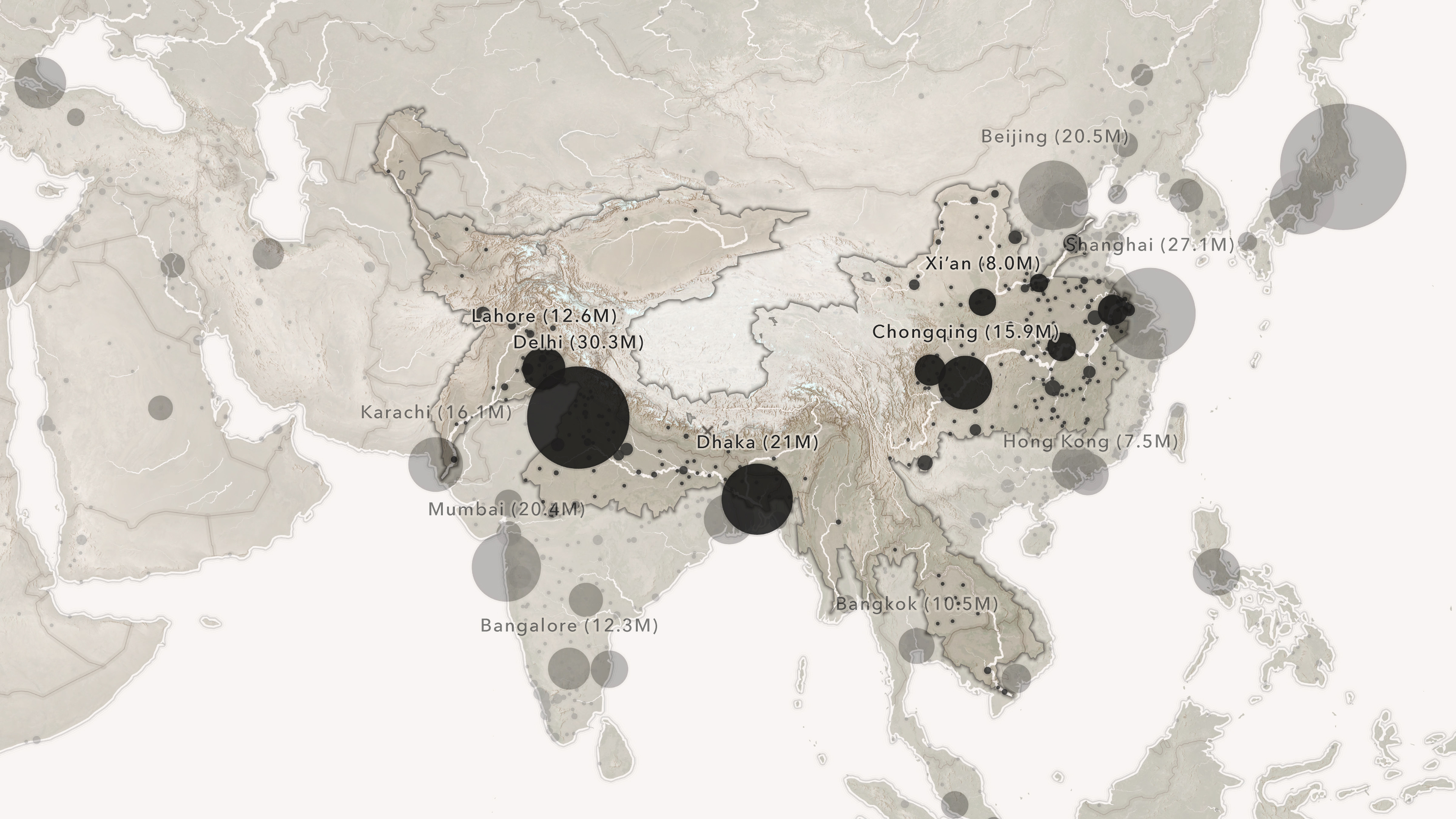
I created these static maps for story about a National Geographic expedition to Mount Everest. The first map is a simple locator; the rest are presented sequentially in the story, showing (in order) the ten major river systems fed by the Hindu Kush-Himalaya ranges, the population density within that mega-basin, and city populations in the region.
Read the full story here.


